
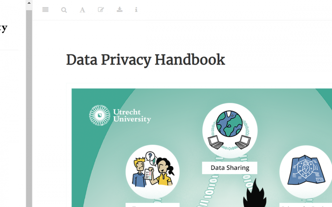
UU Data Privacy Handbook
For the past year at Utrecht University I have been contributing to the Privacy Handbook project as a reviewer. The primary writer, Dorien Huijser, organized a great group of privacy professionals and support staff, monthly meetings with healthy discussions and...
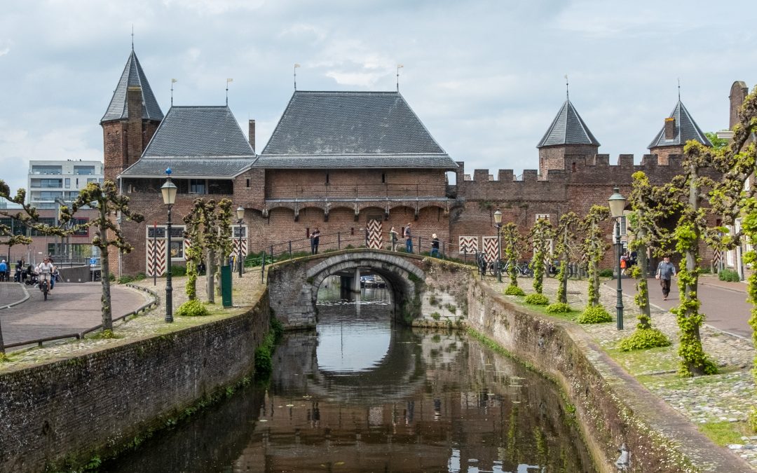
Amersfoort Koppelpoort
My family was visiting, and as a tourist outing we went to Amersfoort, the second largest town in Utrecht province, to have a picnic lunch and see the historic Koppelpoort. We had plenty of time in the day, so I took the opportunity to make a 3D model of the...
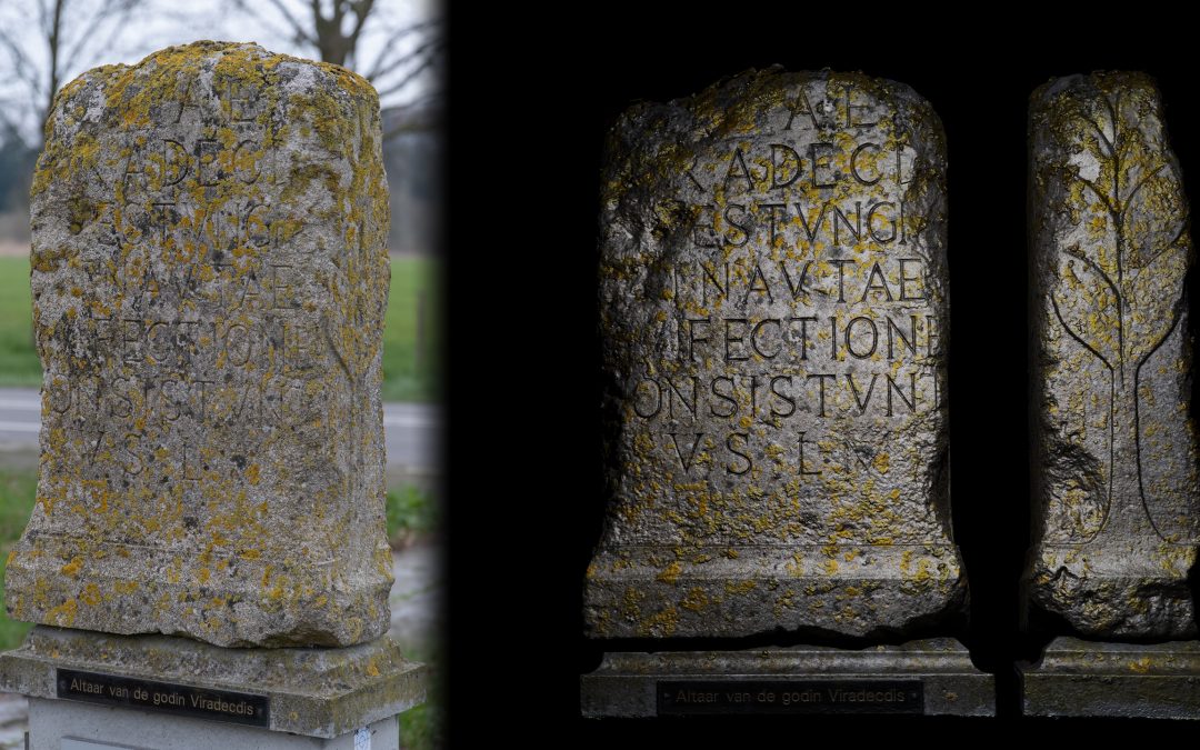
Replica Altar of Viradecdis near Bunnik
In the spring, summer and fall after work on days I rent a bike at Utrecht Centraal I like to take long meandering routes back to the station. Near Bunnik, south of the Utrecht Science Park,...
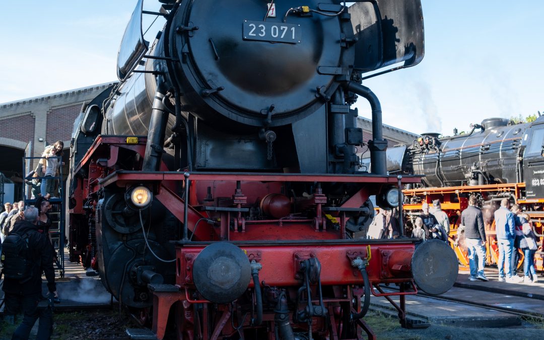
Stoomtrein Dagen 2022
Yesterday I took a modern train to Gouda to ride one of the steam train shuttles between Gouda and the Stoom Stichting Nederland depot near Kralingse Park in Rotterdam. The steam trains are German engines and old...
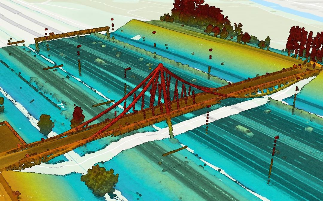
Nelson Mandelabrug in LiDAR
I went for a 65km bike ride from Capelle aan den IJssel through Hitland Park up to Gouda, and then a meandering ride west through Zoetermeer to Nootdorp, and while I was in Zoetermeer I passed over the Nelson Mandelabrug. The Nelson Mandelabrug is a pedestrian and...
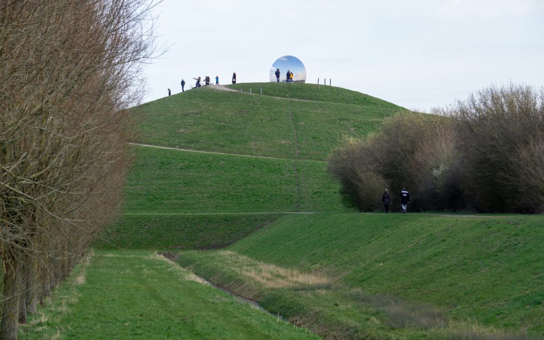
A Visit to the Gaatkensbult
The Gaatkensbult is an artificial hill in Carnisselande near Barendrecht, the Netherlands. During the construction of the Jan Gerritspolder Dike along the Oude Maas river in the early 2000s, a 15 meter tall hill was built atop a section of the dike, and they placed a...
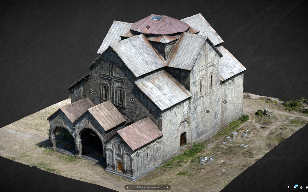
Sketchfab Cultural Heritage Top 10 Model
A model I made of Akhtala Cathedral in northern Armenia made the Sketchfab Cultural Heritage and History Top 10 list for 2021 week 9! See the model below and the full top 10 list on the Sketchfab website. [sketchfab id="7fd9d70dabc64003ba901330079d450a"...
Unintentionally Long Bike Ride Map
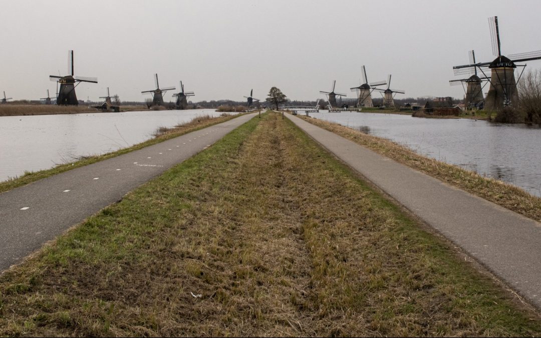
This morning I only intended to go to Kinderdijk to see the UNESCO World Heritage site near Rotterdam, easily accessible by boat, but that trip took a lot longer than I expected. I rode the ferry from Erasmusbrug to Ridderkerk, and then another ferry from Ridderkerk...
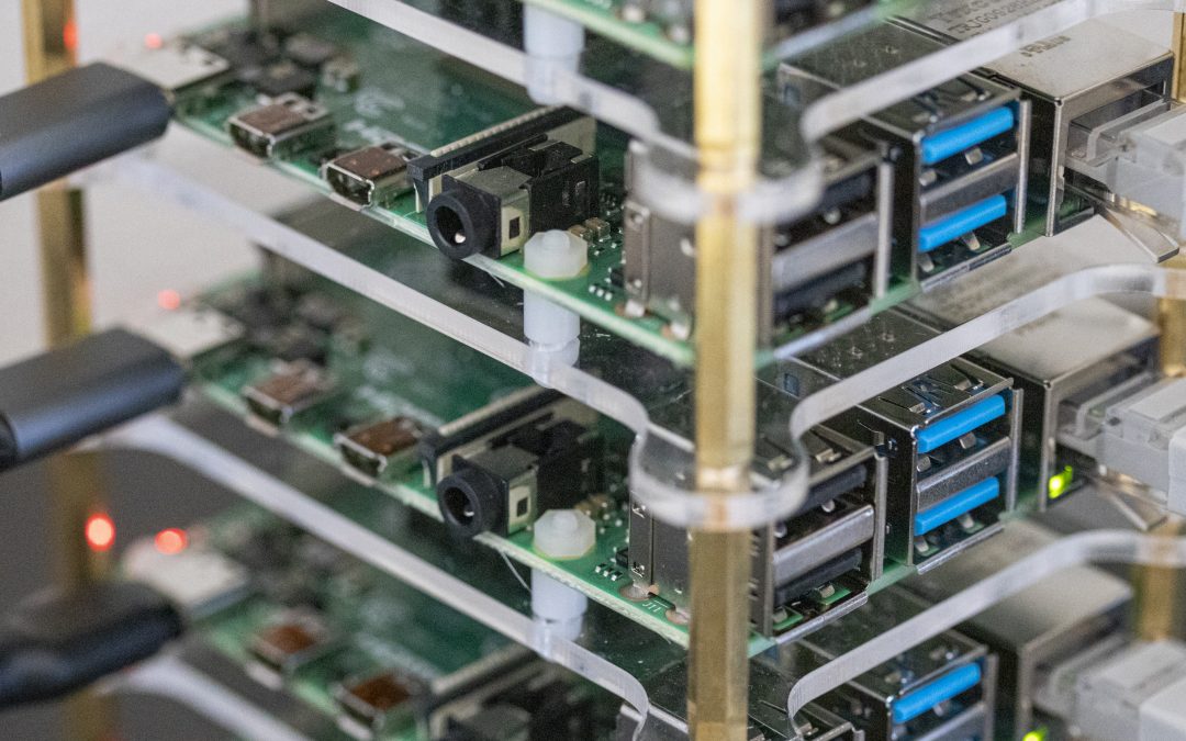
Raspberry Pi 4 GIS Cluster
I have been getting excited with the recent developments in the Raspberry Pi realm, the ARM processor ecosystem, and the magic of containerization, particularly from the Ansible and Kubernetes developer Jeff Geerling. He has had several video series on building and...
Certification Earned: AWS Certified Cloud Practitioner
I passed Amazon Web Services (AWS) Certified Cloud Practitioner exam on January 6, 2021, it is valid for 3 years with an expiration of January 6 2024. This is my first AWS exam, and I plan on taking the Certified Solutions Architect Associate exam next in a few...