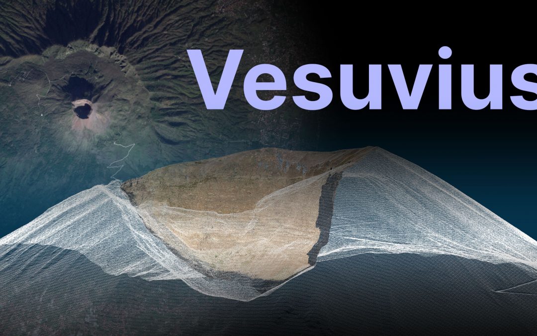
by gspeed | Jan 14, 2025 | GIS, Photography, Portfolio, Programming, Travel
I got the chance to go to Vesuvius this past December, and while hiking the giant I made a bunch of 3D models and panoramas. I made a YouTube video about the trip, and a Streamlit app to let you explore the data from your computer. Streamlit App Zenodo Data...
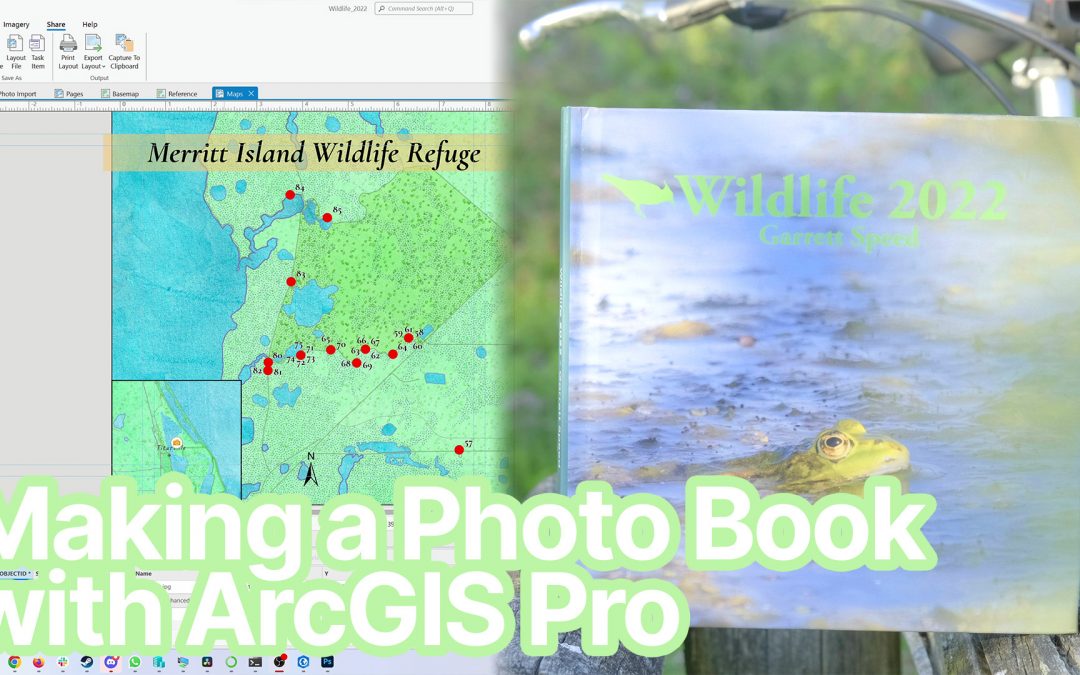
by gspeed | Sep 1, 2023 | GIS, Nature, Photography, Portfolio
I make a wildlife photo book for my close friends and family every year, and for the past two years it has been with the data driven pages in ArcGIS Pro. In this video I show you how I go from Lightroom to ArcGIS Pro to make a beautiful pages with information...
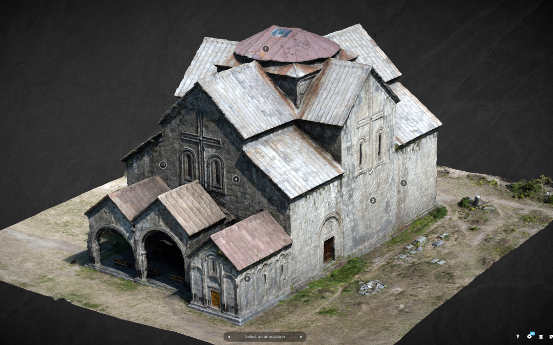
by gspeed | Mar 5, 2021 | GIS, Photography, Portfolio, Travel
A model I made of Akhtala Cathedral in northern Armenia made the Sketchfab Cultural Heritage and History Top 10 list for 2021 week 9! See the model below and the full top 10 list on the Sketchfab website. ...
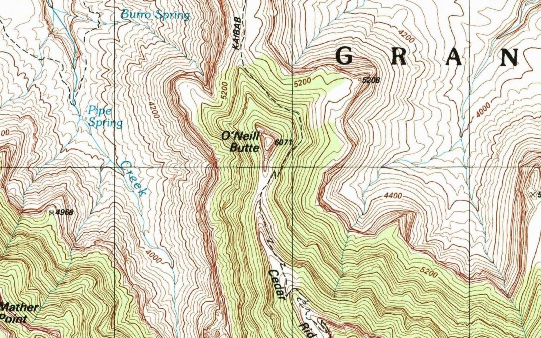
by gspeed | May 25, 2020 | GIS, Portfolio
I was watching videos on Intel Realsense devices the other night and noticed a little detail in one of the videos on making a 3D image Facebook post, and quickly came up with a workflow to create a 3D USGS Topo. The technique I came up with works really well for areas...
by gspeed | Feb 23, 2020 | GIS, Portfolio
Below is my poster from the Florida Academy of Sciences 2019 on the 2017 Land O Lakes, FL sinkhole and flying a drone at the site to monitor its changes. Interactive Drone Imagery Map Comprehensive Sinkhole...
by gspeed | Dec 31, 2019 | GIS, Photography, Portfolio, Travel
This past July at the ESRI User Conference they debuted a new Story Map template that is going to replace the old Story Map template. While I have moved on from using Story Map Journal for individual travels, I thought throwing together a year in review travel Story...
