by gspeed | Jan 18, 2026 | GIS, Programming
by gspeed | Mar 6, 2025 | Programming
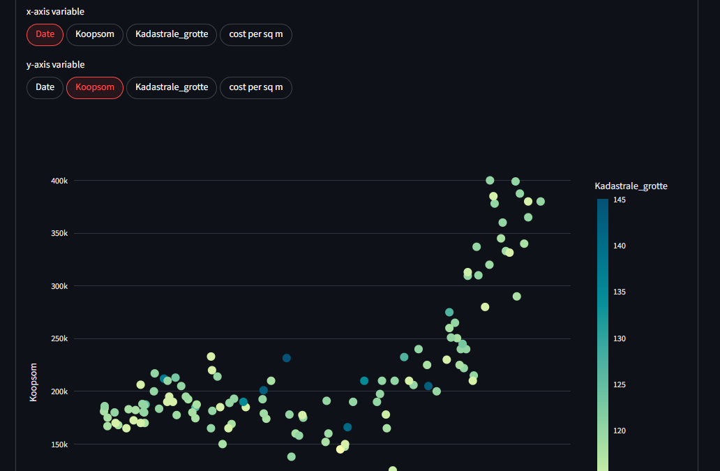
The Utrecht University programming community has a monthly Programming Cafe where someone presents on a programming example. The March 2025 programming cafe on 6 March was my turn, where I presented an introduction to Streamlit, and several of the Streamlit dashboards...
by gspeed | Jan 14, 2025 | GIS, Photography, Portfolio, Programming, Travel
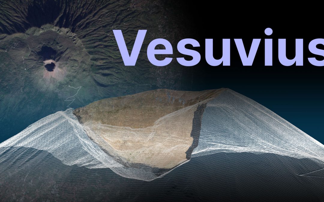
I got the chance to go to Vesuvius this past December, and while hiking the giant I made a bunch of 3D models and panoramas. I made a YouTube video about the trip, and a Streamlit app to let you explore the data from your computer. Streamlit App Zenodo Data...
by gspeed | Jun 3, 2024 | Programming
For the 2024 SURF Research Day I presented a Pecha Kucha on a project to recover data off of legacy data formats, I recorded the presentation and uploaded to...
by gspeed | Jan 28, 2024 | GIS, Photography, Programming
Every year I make a wildlife photo book for my close friends and family highlighting my best wildlife photos of the previous year. I make the book in ArcGIS Pro using two sets of data driven pages, maps and photo pages. The map pages show the viewer where each photo...
