by gspeed | Sep 30, 2017 | GIS, Nature, Portfolio, Travel
After the recent success of the trip to North Carolina and Georgia for the Total Solar Eclipse last month, I got excited about going on another trip with my friends to take part in an activity we love as a group, kayaking. I recently found out about Voyageurs National...
by gspeed | Apr 21, 2016 | GIS, Portfolio
After seeing a Reddit Today I Learned Post about this canyon, which said the bottom of the canyon is so deep and narrow, some parts only receive 33 minutes of sunlight a day, I decided to make a Web Scene of the canyon. Before the Reddit post, I had not heard...
by gspeed | Jan 15, 2016 | GIS, Photography, Portfolio
On our recent digitization trip to the Haghpat Monastery in Haghpat, Armenia, I used a DJI Phantom 2+ quadcopter to take photos for photogrammetry. You can also check out the mesh of the model seen in the video on SketchFab. I took roughly 350 jpeg photos using...
by gspeed | Dec 5, 2015 | GIS, Portfolio
Mt. Momotombo erupted December 1, 2015, and I decided to make a 3D Web Scene of the volcano from Landsat 8, Earth Observer 1 Advanced Land Imager (EO1-ALI), and Shuttle Radar Topography Mission (SRTM) data. The volcano last erupted 110 years ago.
by gspeed | May 20, 2015 | GIS, Portfolio, Travel
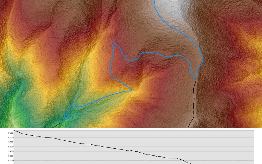
A friend of mine and I recently went to Great Smokey Mountains National Park to go camping. We had initially planned on camping at the Spruce Mountain campsite, but the road to get there was closed until later in the season, so we had to find somewhere else. We...
by gspeed | Apr 25, 2015 | GIS, Portfolio
Volcan Calbuco 3D Web Scene The Volcan Calbuco volcano in Chile erupted April 22, 2015, and I created a Web Scene of the volcano. The 3D Web Scene was created in ArcScene with a Landsat 8 image from April 11, 2015 image, and Shuttle Radar Topography Mission (SRTM)...
