This past July I had the opportunity to go to the ESRI User Conference in San Diego, CA. There I had the chance to attend the Education Summit and the main User Conference.
At the Education Summit, I focused on attending sessions related to the administration of licenses on ArcGIS.com and my.esri.com. I focused on those sessions as I am now a site license administrator for the University of South Florida (USF) and I will be performing more maintenance and enabling the teaching faculty and staff to implement ArcGIS for Desktop, ArcGIS Pro, ArcGIS Online, and ArcGIS Enterprise in their research and classes.
One of my favorite sessions was about the Survey 123 Connect desktop app for authoring Survey 123 forms. The different fields and the if this then that functionality makes the application seem like a real alternative to something like Qualitrics. The ability with authoring a survey with the Connect desktop app is also the ability to author forms in multiple languages, and the ability to collect over 23 different kinds of fields. The only drawback is the ability to only collect individual point data, so far there are no points or polygons.

At the main user conference I wanted to focus on the best practices for deploying ArcGIS products for my research group in the USF Library, the Digital Heritage and Humanities Collections (DHHC), as well as for the USF campus at large. My favorite sessions were both for implementations of ArcGIS Enterprise, best practices deploying Image Server and best practices deploying ArcGIS Enterprise on Amazon Web Services (AWS).
Map Gallery
-
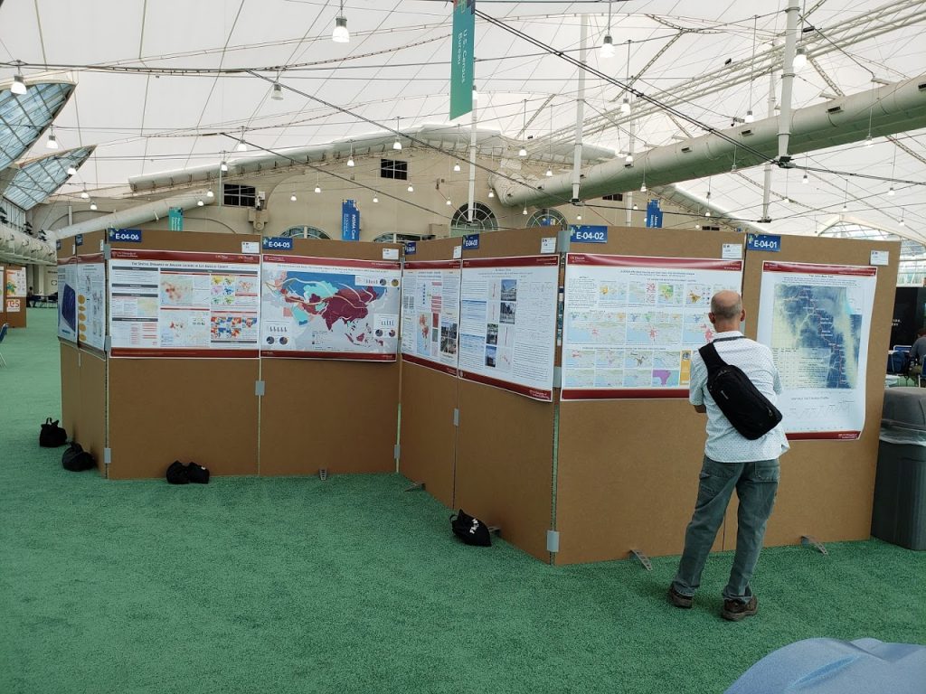
UC Davis’ Map Gallery Template -
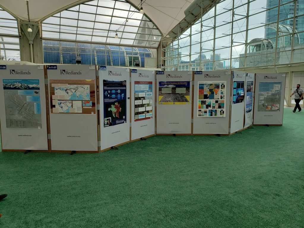
University of Redlands Map Gallery under map branding
The ESRI User Conference always has a map gallery, and I was impressed by the coordination that many of the organizations with several maps have in branding themselves. Many organizations brought with them banners that went under their maps or draped above or below their maps, as seen above with the University of Redlands banners. UC Davis went so far as to make a map template, and they coordinated all of their submissions to use the template. As I’m trying to raise the profile of USF at the ESRI User Conference, it is my mission to enable the USF researchers and students to submit maps to the map gallery and to help brand USF as a university. As we have a limited number of tickets to the User Conference, I will probably be bringing the students posters and the branding that will go along with them.
Trade Show
-
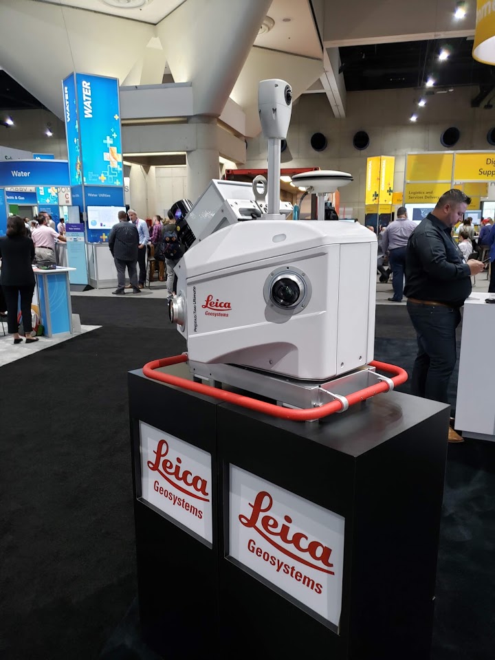
Leica Mobile LiDAR Unit -
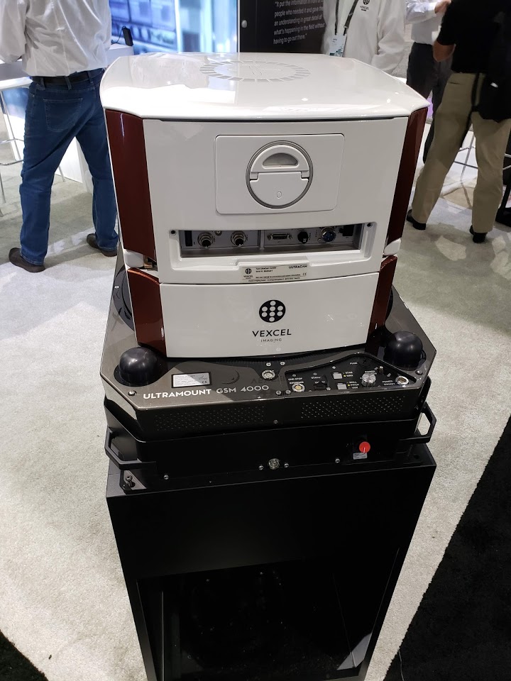
Vexcel Imaging Aerial Imagery Platform -
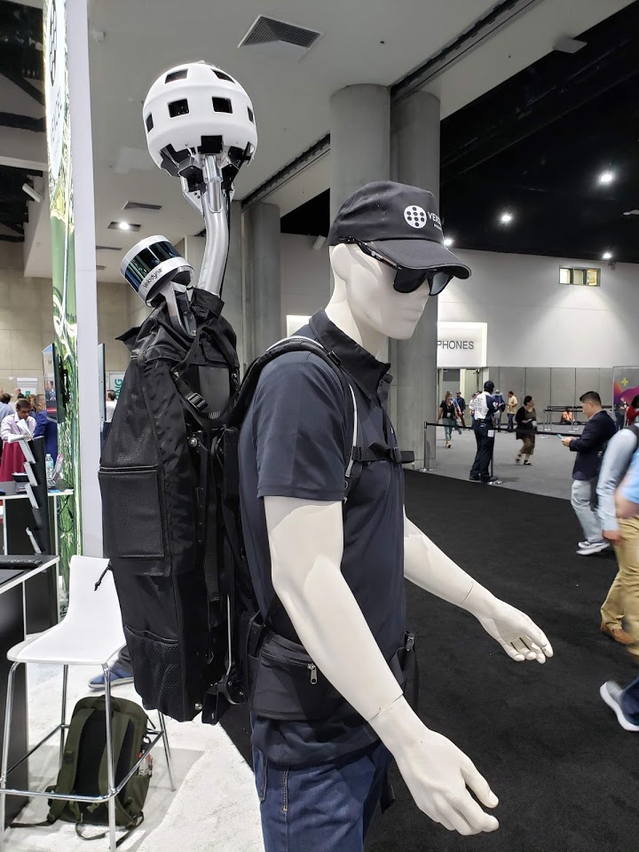
Vexcel Imaging 360 and LiDAR mobile data collection backpack -
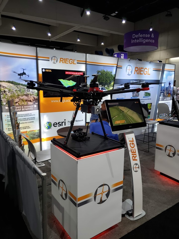
Riegl RiCopter LiDAR UAV -
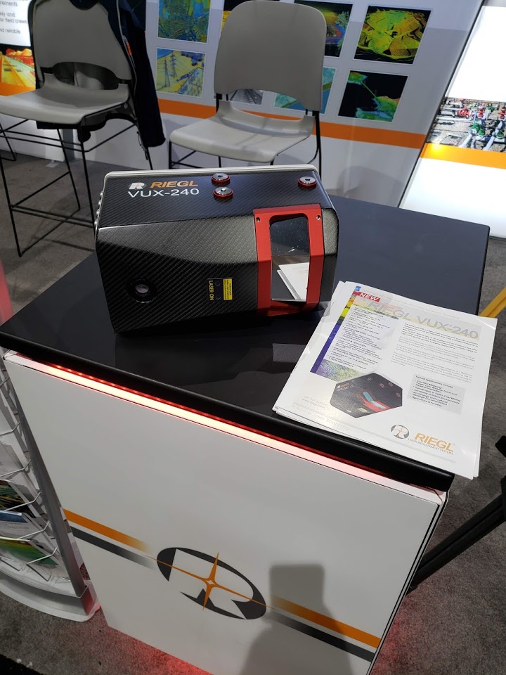
Riegl VUX 240 Aerial LiDAR Collection Platform -
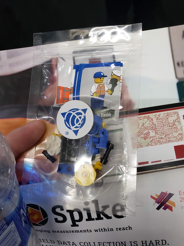
Trimble SiteVision Augmented Reality Lego style figurine
I always enjoy the trade show parts of conferences, getting to see all the latest tech, and especially this time the giveaways (thanks Trimble).
I had already seen Riegl’s UAV offerings while at the ISPRS Geospatial Week, so I stopped by to look at their aerial and mobile LiDAR units. I have been following the development and deployment of the Riegl VMX-Rail mobile laser scanners, and I had a lot of fun talking to the Riegl representatives about the unit and its capabilities.
The Vexcel booth was also a lot of fun, I especially liked the mobile backpack system with the 360 camera and Velodyne puck. I would love to get my hands on one of those, and go map trails, especially in the Great Smokey Mountains, the Grand Canyon, and other National Parks. Their
I spent most of my time at the Trimble booth talking about their GNSS units. I enjoyed the hands on experience with the TDC 100, the TDC 150, and the Nomad 5 data collectors. I got a few of my Geo7x questions answered as that is my main data collector, although they didn’t seem to have anyone around to talk about the issues that are arising with using the Geo7x (or any other Windows Mobile based data collector for that matter). They didn’t have anyone on hand to talk about Trimble Pathfinder Office or Terrasync. The developer lead of the TerraFlex, the Android successor to Terrasync, was at the booth and I got to ask about the replacement workflows for differential post processing with Rinex files, but didn’t really get a solid answer. I’m wary of upgrading to the TDC 150 for our research purposes or investing in TDC 100 for class/lab usage if there’s no clear way forward to do post processing with base station data.
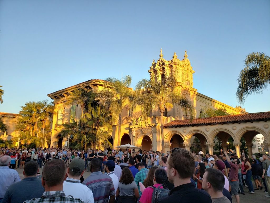
This past July I had the opportunity to go to the ESRI User Conference in San Diego, CA. There I had the chance to attend the Education Summit and the main User Conference.
At the Education Summit, I focused on attending sessions related to the administration of licenses on ArcGIS.com and my.esri.com. I focused on those sessions as I am now a site license administrator for the University of South Florida (USF) and I will be performing more maintenance and enabling the teaching faculty and staff to implement ArcGIS for Desktop, ArcGIS Pro, ArcGIS Online, and ArcGIS Enterprise in their research and classes.
One of my favorite sessions was about the Survey 123 Connect desktop app for authoring Survey 123 forms. The different fields and the if this then that functionality makes the application seem like a real alternative to something like Qualitrics. The ability with authoring a survey with the Connect desktop app is also the ability to author forms in multiple languages, and the ability to collect over 23 different kinds of fields. The only drawback is the ability to only collect individual point data, so far there are no points or polygons.

At the main user conference I wanted to focus on the best practices for deploying ArcGIS products for my research group in the USF Library, the Digital Heritage and Humanities Collections (DHHC), as well as for the USF campus at large. My favorite sessions were both for implementations of ArcGIS Enterprise, best practices deploying Image Server and best practices deploying ArcGIS Enterprise on Amazon Web Services (AWS).
Map Gallery
-

UC Davis’ Map Gallery Template -

University of Redlands Map Gallery under map branding
The ESRI User Conference always has a map gallery, and I was impressed by the coordination that many of the organizations with several maps have in branding themselves. Many organizations brought with them banners that went under their maps or draped above or below their maps, as seen above with the University of Redlands banners. UC Davis went so far as to make a map template, and they coordinated all of their submissions to use the template. As I’m trying to raise the profile of USF at the ESRI User Conference, it is my mission to enable the USF researchers and students to submit maps to the map gallery and to help brand USF as a university. As we have a limited number of tickets to the User Conference, I will probably be bringing the students posters and the branding that will go along with them.
Trade Show
-

Leica Mobile LiDAR Unit -

Vexcel Imaging Aerial Imagery Platform -

Vexcel Imaging 360 and LiDAR mobile data collection backpack -

Riegl RiCopter LiDAR UAV -

Riegl VUX 240 Aerial LiDAR Collection Platform -

Trimble SiteVision Augmented Reality Lego style figurine
I always enjoy the trade show parts of conferences, getting to see all the latest tech, and especially this time the giveaways (thanks Trimble).
I had already seen Riegl’s UAV offerings while at the ISPRS Geospatial Week, so I stopped by to look at their aerial and mobile LiDAR units. I have been following the development and deployment of the Riegl VMX-Rail mobile laser scanners, and I had a lot of fun talking to the Riegl representatives about the unit and its capabilities.
The Vexcel booth was also a lot of fun, I especially liked the mobile backpack system with the 360 camera and Velodyne puck. I would love to get my hands on one of those, and go map trails, especially in the Great Smokey Mountains, the Grand Canyon, and other National Parks. Their
I spent most of my time at the Trimble booth talking about their GNSS units. I enjoyed the hands on experience with the TDC 100, the TDC 150, and the Nomad 5 data collectors. I got a few of my Geo7x questions answered as that is my main data collector, although they didn’t seem to have anyone around to talk about the issues that are arising with using the Geo7x (or any other Windows Mobile based data collector for that matter). They didn’t have anyone on hand to talk about Trimble Pathfinder Office or Terrasync. The developer lead of the TerraFlex, the Android successor to Terrasync, was at the booth and I got to ask about the replacement workflows for differential post processing with Rinex files, but didn’t really get a solid answer. I’m wary of upgrading to the TDC 150 for our research purposes or investing in TDC 100 for class/lab usage if there’s no clear way forward to do post processing with base station data.

